
Local equestrian groups and contact information: (send your info to riverrider@bak.rr.com to add to the list)
1. Kern County Mounted Search and Rescue
http://www.myspace.com/kernmountedrescue
Contact: Volunteer Services 661. 391.7659
2. Backcountry Horsemen of California - Kern Sierra Unit
Contact:
3. Equestrian Trails, Inc. Corral 65 (Bakersfield)
Contact: Helen Ordway, President
hordway@tri-valleycorp.com
A nonprofit corporation established in 1944 with the Charter to be "Dedicated to the Acquisition and Preservation of Trails, Good Horsemanship, and Equine Legislation." A family oriented riding club. http://www.etinational.com/
4. Kern Equestrians for Preservation of Trails
Contact: Carolyn Belli, President 661-872-3569
jgbelli@bak.rr.com
KEPT is a non-profit equestrian organization providing solidarity to network with and represent all equestrian organizations and individuals on issues relating to trail preservation and education.
5. Golden Empire Arabian Horse Society
Web page: http://www.geahs.org/
Contacts: Marci Cunningham 324-7376
Susan Pugh 589-5246
"GEAHS members are dedicated to the promotion of the Arabian Horse as an all around, show, riding, endurance and family horse. Within our club we have many successful show people and horses, endurance riders, breeders, trainers and people who just enjoy the relationship they have with their Arabian Horses."
6. Northwest Gymkhana Association
Contact: Claudia Payne - Show Secretary 661 342 1056
A non-profit family oriented club. We have 13 speed/skill events to test the rider and horse at 5 different levels of skill. We are the largest California gymkhana club.
7. Kern River Chapter of the California Dressage Society
Contact: Jane Curtis - 387-0124
8. Kern County Appaloosa Club
Contact: Melanie Burkhart at 747-5810.
9. Golden Empire Appaloosa Horse Club
Contact: Dan Gilbert 366-5036
10. Bakersfield Heat Wave Equestrian Drill Team
http://www.bakersfieldheatwave.com/
Contact: Claudia Hewes - 661 - 587-6000
We are a non-profit corporation and we are always looking for more riders to join in on the
fun.
11. Rodeo Starlets Equestrian Drill Team
Contact: Julie Glenn 661.333.9754
Practices are on Saturdays at 6 p.m. at Robertson Stables, Bakersfield, CA.
We have performed at the following rodeos this year: Whiskey Flats, Needles and Woodlake and are planning more to come. Additional practices in Tehachapi; riders from Tehachapi are welcome.
12. GHEC - Golden Hills Equestrian Club (Tehachapi, CA)
Contact: http://www.ghequestriancenter.com
mmoors@bak.rr.com
22347 Woodford-Tehachapi Rd., Tehachapi, CA 93561
661.822.7062
Full facility equestrian center which hosts horse shows/play days/camps/clinics/holiday events and more.
Tuesday, April 28, 2009
Sunday, April 19, 2009
No signs on trail from Hart Park to Lake Ming, where do we ride?
Marion, a frequent river rider would like to share the following concerns:
I really enjoy riding from Hart Park to Lake Ming and sometimes beyond. We trailer to the Hart Park barn and ride east from there. In the past, if I recall correctly, I have seen one sign indicating the horse trail that was somewhere along the stretch of trail before arriving at the Kern River Campground. Ninety percent of the time we have ridden around the south side of the park on the dirt “road” before heading north over the grass, paralleling the bike trail to catch the part of the trail that skirts the north side of Lake Ming, below the lake. There is a trail map sign at that juncture that seems to indicate that the horse trail would go through the park, riverside, but with all of the campers, including dogs and children, that seems an unwise way to go. Last year, when riding around Lake Ming at the west end of the lake, a Park Ranger stopped us and told us that we could not go that way, that when going by the park, we were supposed to head over the hill way south of the park. His directions were not clear to us and there seemed to be no marked trail. Furthermore, what he was saying did not seem to coincide with what the trails plan/map indicated, nor what was the traditional horse trail before they installed the paved bike trail.
When we ride that area, we always try our very best to be thoughtful and courteous in how we proceed. That is only common sense in a multi-use area. That being said, however, it is difficult to stay on designated trails if they are not properly signed. I believe that we need trail signs indicating the horse trails and with multiuse trails, some guidelines to educate users regarding who should yield to whom.
A neighbor just returned from camping with her RV at the Kern River Campground for the weekend. She is horse friendly, but also has had grandchildren playing in the campground. Twice, she has encountered equestrians riding through the occupied campgrounds, riverside. Today, two men rode through, back and forth, one on a stallion which she said was out of control, with the rider explaining that his horse was reacting to the mare across the river who was in heat. The horse was dancing around, backing up to the picnic table where people were seated. These equestrians was not only putting campers at risk, they were jeopardizing our equestrian access to trails!
I am thinking that if we had signs designating where the trail should go, that some of these problems would be avoided or minimized. I don’t know what has been done to try to accomplish this before, but I believe it is a basic need for maintaining trails within our ever developing urban environment. What do you (all) think?
Editor's response: This is a great post Marion, it brings up the problems that can occur when the trails are not clearly marked and results in riders going into areas that are not safe for the horses or the community. We want the trails to be protected to keep us safe and others around us.
Anonymous said...
It's been a while but the one time we met up with a ranger while riding by the campground, we were told that the dedicated trail does indeed go between the campsites and the river. Without a fence of some sort, like the bridle path has through Hart Park, we will be running into the tents that are set up close to the river's edge.
Thursday, April 9, 2009
Panorama Preserve Volunteer Days

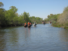
This is a picture of Roberta riding Duffy and enjoying the Panorama Preserve and checking out the little "Frying Pan Poppies". Do you love the Panorama Preserve? Would you like to be involved in this great project? Then read on:
Submitted by Marci C:
Hi All!
We will be having two volunteer days at the preserve in the coming weeks.
April 25th 8am-12noon
May 9th 8am-12noon
The April cleanup will be concentrated around the staging/parking area on the north side of the river. We will be pulling weeds in the parking lot and clearing trash and dead shrubs and trees. We will also be repairing the fencing where it is sagging. If that is finished early, we may weed and spread mulch around the young trees on the Preserve.
The May cleanup is sponsored by East Rotary Club. Again, on the north side of the river we will be collecting tumbleweeds and disposing of an old wood pile and as time allows may weed and spread mulch around the young trees.
We will provide water/drinks and a snack. Please bring gloves, rakes, shovels or anything you think might be helpful.
If you have any questions, please call me at 872-3569 or e-mail me at jgbelli@bak.rr.com
Thanks! Carolyn
Ed. Note: The Panorama Preserve is an area that has been acquired through the hard work of individuals who knew who to contact, which buttons to push, were willing in some cases to donate money, and/or were willing to donate sweat. The preserve is an area that surrounds the north and south sides of the Kern River between China Grade Loop Road and Manor Ave.
A handful of people regularly show up to plant, water and weed to return the preserve to its former status. This is your opportunity to join in and help. Contact some friends and make it a fun outing and be able to tell your grandkids that you were there!!!!!! For more information about the preserve go to the website:
Tuesday, April 7, 2009
Joint County/City Meeting
Bob W. sent the following information:
NOTICE OF SPECIAL JOINT MEETING
KERN COUNTY PLANNING COMMISSION
AND THE
BAKERSFIELD CITY PLANNING COMMISSION
NOTICE IS HEREBY GIVEN that the Kern County Planning Commission and the Bakersfield City Planning commission will hold a Special Joint Meeting on Monday, April 20, 2009, at 6:30 p.m. in the Chambers of the Board of Supervisors on the First Floor of the Kern County Administrative Center, 1115 Truxtun Avenue, Bakersfield, California. The focus of this meeting is the update of the Metropolitan Bakersfield General Plan.
1. PLEDGE OF ALLEGIANCE
2. ROLL CALL
3. OPENING REMARKS BY CHAIR RON SPRAGUE
4. OPENING REMARKS BY CHAIR RUSSELL JOHNSON
5. PUBLIC STATEMENTS
6. BUSINESS ITEMS
A. Joint Workshop - Metropolitan Bakersfield General Plan
1. INTRODUCTIONS - County Staff
2. MEETING PURPOSE AND OVERVIEW - City Staff
3. PUBLIC OUTREACH REPORT SUMMARY - Northcutt & Assoc.
4. EXISTING CONDITIONS REPORT SUMMARY - PMC, Inc.
5. EXTERNAL INFLUENCES ON GENERAL PLAN UPDATE PROCESS
a. SB 375/AB 32/AB 170: Implications/Summary - County Staff
b. Attorney General Implications - City Staff
6. URBAN - OPPORTUNITIES AND RESERVE MAP - Northcutt & Assoc.
7. PUBLIC COMMENTS
8. COMMISSIONER COMMENTS/QUESTIONS
9. NEXT STEPS/SCHEDULE - County Staff
7. CLOSING COMMENTS BY CHAIR RON SPRAGUE
8. CLOSING COMMENTS BY CHAIR RUSSELL JOHNSON
9. ADJOURNMENT
Monday, April 6, 2009
The Trail up Alfred Harrell Hwy hill


At one time this trail was well maintained, I think by the public rental stables that were located at the Silverado Stable site. (Was it called the B Bar stables?) And then some Backcountry Horsemen members fixed the fence. But in the past few years it has taken some bad hits (literally by cars that went through the fence and over the cliff) The result is that the trail has some bad ruts and the fence is down in some crucial areas. It would sure be nice to have the fence repaired and a metal barrier (bottom photo) put up to stop cars from going over the cliff. Just another item for my wish list when the economy gets better...
Pat Mumford has some answers: It was Bar O Stables and the Kern Sierra Unit of the Backcountry horsemen did a cleanup of the trail about 5 years ago. It's a wonderful hill with great views, although it is right next to Alfred Harrel Highway, it is the only way to get to Goodmanville (and on to Hart Park) from Ethel's.
Alfred Harrell Hwy. crossing

I'm a little concerned about crossing Alfred Harrell Hwy. at the east entrance of Hart Park. It is a 3 way intersection but cars coming from the soccer park are not required to stop. They are coming around a curve and sometimes are traveling at a high rate of speed. We always take it very carefully when crossing from the barn to the river trail. Also, the cars coming out of the park toward the soccer park don't have to stop, but they are usually travelling slower. I think it would be safer for everybody if they added stop signs for these two routes. Just my opinion, what do you think?
Koztarr has left a new comment on your post "Alfred Harrell Hwy. crossing":
I don't think stop signs will be installed but it would help if equestrians requested horse crossing signage be installed in all directions to make drivers aware of horses crossing the road. I have called Bob Lerude of Kern County Parks and talked to his assistant about the possibility of such signs and am waiting to hear back from him. Other are encouraged to call county parks and make the same request. Ed. Note: Hart Park Field Office number is (661) 872-3179; Park Rangers - (661) 872-5149. The County Park address is 1100 Golden State Ave. 93301 if you want to send any letters; and the email is parks-web@co.kern.ca.us If you are so inclined to contact park or city administrators, I would ask you to remember to think of two good things to comment on for every "not so good" thing. We really are lucky to have the wonderful trails we have in Kern County, but they must be preserved.
Hart park Barn
Sorry, no picture of the barn at this time, I'll add it sometime this week. But I would like to start a posting about the barn and hope to get input from "y'all". The barn is old and at one time almost fell down. Then someone organized a "barn raising" and repaired it. It is now a great staging area and nice place for a picnic. It has parking, several pens, water, tables, and a wash rack for a hot horse. If you have info on the who's and when's, let me know and I'll redo this post and add the picture.
Koztarr said...
Koztarr said...
Horseman John Hustead was responsible for getting the barn cleaned out and repaired about 10 to 12 years ago. He also got the portable panels donated or if not donated they were purchased at a great price. A barn dedication/trail ride/barbecue was held and drew a big crowd. We all owe a big thank you to John for his work. He still rides along the Kern River.
Hart Park


I really love the Hart Park ride. I t was designed right and has been pretty well maintained. The fencing is nice and sturdy, although it is falling down in some places and completely gone in other areas. (One of the photos shows a leaning fence and another shows a repaired fence, can you see the shiny, new bolts?) Notice also that the management has taken the trouble to mow about a 4-5 foot path along the fence which helps avoid stepping in hidden holes.
A couple of years ago there was a lot of damage to the river banks due to the high river flow. (one of the photos shows a hole extending in to the old trail, but the fence was removed to allow horses to move away from the hole.)
The photo with the fresh dirt shows that the county is taking care of the problems, this was a HUGE hole and has been filled in and the fence repaired.
I went down to take a picture of the bridge because I've always been impressed with the good construction. Sadly, when I went to take the picture it was blocked off and closed. I'm assuming that it is unsafe for some reason. However, I think this just backs up the argument that the Hart Park management is on the ball and is checking on the status of the bridge because my untrained eye couldn't see a problem. I hope it gets repaired soon, otherwise horses will have to go up on the main road and cross on a car bridge. The other thing I like about this bridge is that it is a good training tool for horses to walk on wood and deal with unfamiliar situations.
I have been told by a reliable source that the bridge is scheduled to be replaced when a large culvert pipe is installed to allow drainage under the existing bridge and the suface will then be a natural dirt surface. Ed. note: Thanks Koztarr for the update, this would make sense with the past experience I have had with the Hart Park management. Hart Park has always been a jewel of Kern County. It is well managed and well enforced by Park Rangers (as I well know when I have been politely asked to ride on the established trails when I have gotten off the trail a little...ooops!)
Photos of Stockdale Staging Area


Well, I finally got a chance to go out and take a first hand look of the new staging area.
First, let's discuss the good: it's in a good location, the road was well made and there is a nice "turn around" area at the end.
The problems: 1) dirt was moved from the baseball area which raised the parking area, this resulted in a 30% grade in some areas. (See the first photo) Now, if you park your rig on the pavement, you should be able to tie your horse to the trailer and keep your horse on level ground. If you pull off and park on the dirt, which is what you are supposed to do...you may have your horse standing on a 30% angle resulting in your pad and saddle slipping off if you don't cinch up pretty quick.
2) Where are we supposed to ride our horses if we can successfully saddle up? There is a pedestrian bridge to the river (3rd photo) (which we have been told we are not to use) or the dirt road between Goose Lake Slough and the Cross Valley Canal (which has been closed off by a locked gate 2nd photo) So, do we take a chance with the bridge or ride around the baseball diamonds for awhile?
3) The baseball diamond parking is limited, how do we prevent the baseball parents from using our parking area? We will need signs and enforcement to reserve this area.
FYI: to get to the staging area, you have to come north from Stockdale Hwy. The turnoff can not be accessed from the southbound lanes due to a concrete island. Not a biggie, but I just thought you would want to know before you have to drive around the block to get the right approach.
This staging area is not a "dead horse", excuse the pun, but it will be if we don't inform the planning department of the problems.
I have been in touch with the city engineer regarding this staging area and he has indicated that a new equestrian access to the Pioneer Canal bank will be installed adjacent to the pedestrian bridge. Also, the city crews will continue to shape the shoulder/parking area to provide level areas. The Kern County Water Agency will be updating the fence so the city will coordinate earth work with fence replacement. The city is looking into using a material similar to rock dust for surface topping. Signage will be installed on the fence to indicate euestrian parking only. Much of this work will be done after the grand opening of the ball fields scheduled for April 18th. My friend and I parked two large rigs along the fence near the turn around and were able to park off the dirt and saddle with no problems. I would suggest that the bridge be used until the new equestrian access is installed. Happy trails to all.
Subscribe to:
Posts (Atom)